Jordan Franke · 13 October 2026
Exploring How Historical Tidal Records Shape Infrastructure Resilience Strategies in Vulnerable Waterfront Communities
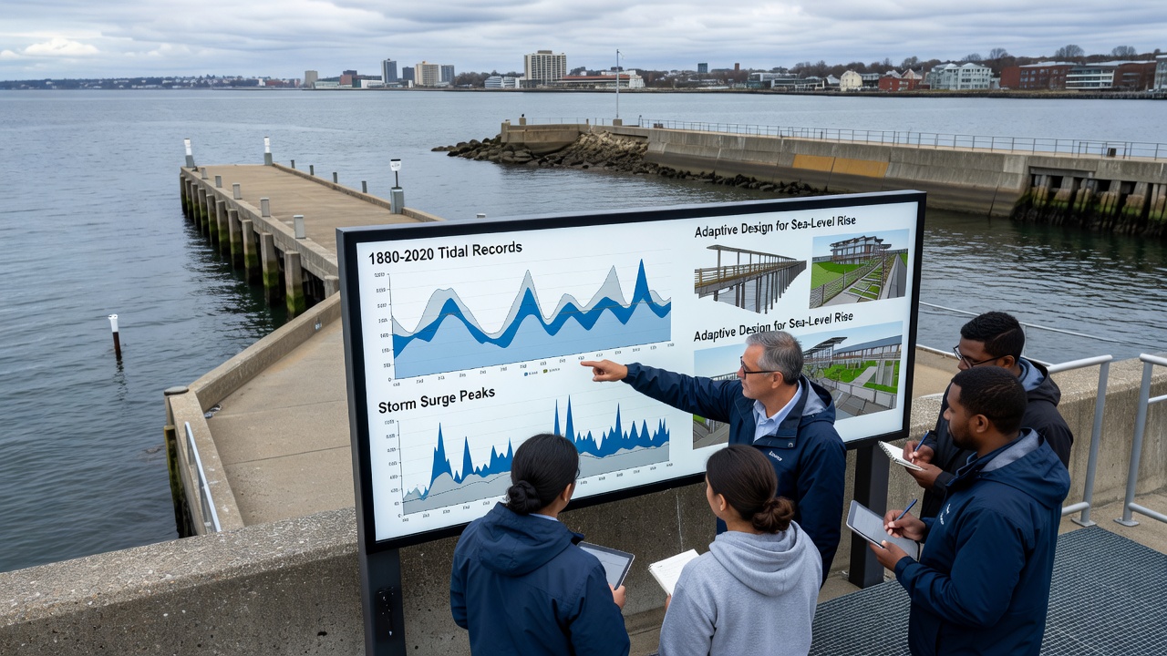
Historical tidal records collected over decades from gauges installed along coastlines provide baseline measurements that engineers and planners use to determine flood elevations, setback distances, and structural reinforcements in communities exposed to regular inundation, and these datasets reveal long-term patterns of sea level change that directly influence decisions on elevating roads, reinforcing seawalls, and redesigning drainage systems. Observers note that communities in low-lying areas often rely on records spanning 50 to 100 years to calibrate models predicting future high-water events, which allows for targeted investments rather than blanket protections across entire shorelines.
Collection and Analysis of Long-Term Tidal Data
Researchers compile measurements from permanent tide stations operated by national agencies, where instruments record water levels at regular intervals and account for factors such as lunar cycles, storm surges, and gradual land subsidence; data from these sources show that average high tides have risen steadily in many regions since the early twentieth century. What's interesting is how analysts cross-reference these figures with satellite altimetry and geological surveys to separate local vertical land movement from global ocean volume changes, creating more accurate projections for infrastructure that must last 50 years or more. Studies indicate that gaps in older records are filled through proxy data from harbor logs and eyewitness accounts preserved in municipal archives, though these supplementary sources require careful validation against instrumented readings.
Application in Infrastructure Planning
Engineers incorporate historical tidal extremes into design standards for bridges, pump stations, and utility networks, setting minimum elevations above the highest recorded levels adjusted for projected acceleration in sea level rise; this approach has guided projects in port cities where older infrastructure built without such data now faces repeated flooding during king tides. According to figures from the National Oceanic and Atmospheric Administration, updated tidal datums released in recent years have prompted several municipalities to revise building codes and require additional freeboard on new construction. But here's the thing: communities that integrate these records early in the planning process avoid costly retrofits later, as demonstrated by coordinated efforts in regions where multiple jurisdictions share watershed boundaries and coordinate on joint protection measures.

Regional Examples and Implementation Outcomes
In the Netherlands, authorities have long used centuries-old tidal observations to refine the Delta Works system of barriers and dikes, adjusting crest heights based on statistical analysis of extreme events rather than single catastrophic floods. Similar methods appear in Australian coastal management plans where state agencies reference tide gauge networks maintained by the Bureau of Meteorology to set requirements for new subdivisions in flood-prone zones. One study revealed that waterfront neighborhoods incorporating these historical benchmarks into resilience strategies experienced fewer service disruptions during recent high-water episodes compared with areas relying on shorter datasets. People who've examined post-project evaluations often discover that combining tidal history with climate scenarios produces infrastructure that performs reliably under both routine conditions and intensified storm events.
Developments Anticipated for October 2026
Updated global tidal datasets scheduled for release in October 2026 will incorporate expanded coverage from additional stations installed in the preceding years, enabling finer resolution modeling for communities where micro-tidal variations affect drainage performance. Government agencies in multiple countries plan to align new infrastructure guidelines with these revised datums, which may accelerate permitting processes for elevation projects already in design phases. What's significant is how this timing coincides with ongoing assessments of existing defenses, allowing planners to compare recent observations against the long historical baseline and identify locations where incremental upgrades can extend service life without full replacement.
Conclusion
Historical tidal records continue to serve as foundational inputs for infrastructure resilience strategies in waterfront communities worldwide, guiding everything from elevation standards to drainage network designs through documented patterns of water level behavior. Data from established monitoring networks support decisions that balance immediate safety needs with long-term adaptability, while coordinated updates expected in 2026 will further refine those calculations. Observers note that sustained investment in record-keeping and analysis ensures communities can maintain functional infrastructure even as environmental conditions evolve.